University of Minnesota
http://www.umn.edu/
612-625-5000
http://www.umn.edu/
612-625-5000
Minnesota Biodiversity Atlas
Bell Museum
Dataset: MIN-Plants
Search Criteria: Canada; British Columbia; Mackenzie; excluding cultivated/captive occurrences
1
Page 1, records 1-6 of 6
Bell Museum plants | |
 MIN:Plants | 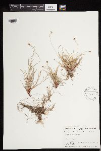 Carex deflexa Hornemann 579606[1293073]Raup, H.M. 9167 Canada, British Columbia, Mackenzie |
MIN:Plants | 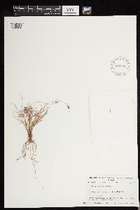 Carex deflexa Hornemann 579544[1293072]Raup, H.M. 9284 Canada, British Columbia, Mackenzie |
MIN:Plants | Cypripedium passerinum Richardson 580096[1310082]Raup, H.M. ;;; Soper, J.H. Canada, British Columbia, Mackenzie, Detailed locality information protected. This is typically done to protect rare or threatened species localities. |
MIN:Plants | 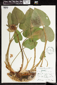 595761[1335734]Cody, W.J. 90141955-07-27 Canada, British Columbia, Mackenzie, Fort Simpson; Around border of slough near Royal Canadian Corps Signals Transmitters., 61.859717 -121.363545 |
MIN:Plants | 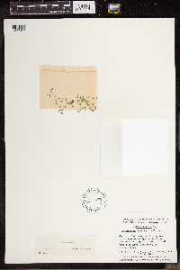 595672[1337168]Cody, W.J. 84071955-06-28 Canada, British Columbia, Mackenzie, Fort Simpson; Northwest Territories; in small pond near Royal Canadian Signal Transmitters., 61.85 -121.333333 |
MIN:Plants |  Lemna turionifera Landolt 595714[1337236]Cody, W.J. 84061955-06-28 Canada, British Columbia, Mackenzie District, Fort Simpson; Northwest Territories; near Royal Canadian Signals Transmitters., 61.85 -121.333333 |
1
Page 1, records 1-6 of 6
Google Map
Google Maps is a web mapping service provided by Google that features a map that users can pan (by dragging the mouse) and zoom (by using the mouse wheel). Collection points are displayed as colored markers that when clicked on, displays the full information for that collection. When multiple species are queried (separated by semi-colons), different colored markers denote each individual species.